Last updated: 28
Jul
2025
Existen numerosos sitios históricos de peregrinación budista en Nepal.
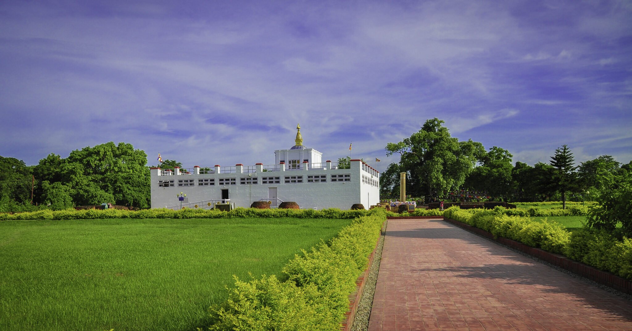
Lumbini es el lugar donde la reina Mayadevi dio a luz a Siddhartha Gautama en el año 563 a.C.
El lugar de nacimiento del Buda cerca de Kapilavatthu en Nepal. Uno de los cuatro sitios de peregrinación mencionados en el Mahaparinibbana Sutta.

Swayambhunath es una antigua arquitectura religiosa situada en la cima de una colina en el Valle de Katmandú, al oeste de la ciudad de Katmandú. El nombre tibetano del sitio significa ‘Árboles Sublimes’, por las muchas variedades de árboles que se encuentran en la colina. También conocido como el «Templo de los Monos» entre los visitantes extranjeros, Swayambhunath se encuentra en la cima de su colina, con vistas a la mayor parte del valle.

Bouddha, también conocido como Boudhanath, Khasti Chaitya y Khāsa Chaitya, es un stupa en Katmandú, Nepal. Ubicado a unos 11 km (6.8 mi) del centro y de las afueras noreste de Katmandú, su masivo mandala lo convierte en uno de los stupas esféricos más grandes de Nepal y del mundo.

El Stupa de Charumati (también conocido como Stupa de Chabahil y Stupa de Dhan Dhoj) es un stupa en Katmandú, Nepal. Fue construido por Charumati, hija del emperador indio Ashoka, en el siglo IV. En 2003, el Stupa de Charumati fue restaurado por los lugareños ya que se estaba desmoronando debido al «intenso tráfico vehicular en la carretera cercana». Durante su proceso de restauración se encontraron innumerables artefactos, monedas y manuscritos que posiblemente datan de la era Licchavi.

Pharping es un pequeño pueblo Newar situado sobre el río Bagmati en el borde sur del valle de Katmandú, a unos 23 km de la capital. Ahora forma parte del Municipio de Dakshinkali.

Ramagrama stupa is a stupa located in Ramgram Municipality, in the Nawalparasi District of Nepal. This Buddhist pilgrimage site, which was constructed some 2500 years ago, contains relics of Gautama Buddha.

The Vidhyeshvari Vajra Yogini Temple – also known as the Bijeśvarī Vajrayoginī, Bidjeshwori Bajra Jogini, Bijayaswar, Bidjeswori, or Visyasvari Temple – is a Newar Buddhist temple in the Kathmandu valley dedicated to the Vajrayāna Buddhist deity Vajrayoginī in her form as Akash Yogini. The temple stands on the west bank of the Bishnumati river next to the ancient religious site of the Ramadoli (Karnadip) cremation ground and is on the main path from Swayambhunath stupa to Kathmandu.

Gotihawa is a village development committee located about 4 kilometres (2.5 mi) southeast of Kapilavastu, in Kapilvastu District, in the Lumbini Zone of southern Nepal. At the time of the 1991 Nepal census it had a population of 3,335 people living in 567 individual households.

Kapilvastu is a municipality and administrative center of Kapilvastu District in Lumbini Province of southern Nepal. The municipality is located roughly 25 kilometres (16 mi) to the south-west of Lumbini, a UNESCO World Heritage Site and the birthplace of Gautama Buddha.
Nigalihawa is a village development committee in Kapilvastu District in the Lumbini Zone of southern Nepal. At the time of the 1991 Nepal census, it had a population of 7564 people living in 1231 individual households.

Nigrodhārāma was a Banyan grove near Kapilavastu, where a residence was provided for the Buddha when he visited the city in the first year after his Enlightenment. It belonged to a Sākyan named Nigrodha, the monk who made Ashoka, the Mauryan Emperor a Buddhist; who gave it to the Monastic Order. The Nigrodharama is located at the site of the modern Kudan village, about six kilometres south of Tilaurakot, the citadel of Kapilavastu. The precise location of Nigrodharama is at the following coordinates: 27.528186°N 83.040757°E.

Tilaurakot is a neighborhood in Kapilvastu Municipality in Kapilvastu District, in the Lumbini Province of southern Nepal. Previously it was a Village development committee. At the time of the 1991 Nepal census it had a population of 5684 people living in 944 individual households. It is situated 25 kilometers (15.5 mi) northwest of the Maya Devi Temple in Lumbini, and 4.5 kilometers (2.8 mi) southeast of Nigali Sagar in Nigalihawa.


